7.25.2007

atlas return pt.3


somewhere near the Arizona border in New Mexico


The Texas border sign that I took a picure of on the way to CA was not clear because of the rain. So here is another it's much better.


the view of Memphis from Arkansas side

Finally we were back in Tennessee!!

atlas return pt.2

Mojave 砂漠通過中にガソリンライトが点灯してしまった。慌ててトラックのオーナーズマニュアルを読んでガソリンライト点灯時点でどのくらいのガソリンが残ってるのか調べようと思ってもそんな事はいっさいマニュアルには記載されてない。ロードマップを見ても次の町の印までどうやら40miles以上はある。次の町に着いたからってここは飽くまでも根底的に砂漠の中だしその町にガソリンスタンドがある保証はない。私の座っていた助手席からはもちろんガスゲージは見えない。「なんでこうなる前に給油しにガソリンスタンドに止まんなかったの!!」という思いがこみ上げてきた。いかん、完璧に彼に八つ当たりの体制にはいっている。そんな私の葛藤も知らず隣で一生懸命運転している彼はこの深刻な状況に対して平穏。「もしガス欠になったら、面倒だし時間も食っちゃうけど車を台車から降ろしてガソリンスタンド探すしかないね」なんて言い出し、静かにエアコンのスイッチに手を延ばして消した。これはガソリン確保の体制に入ってる!あいつもヤバいとおもってるんだなっと悟る。そしてジンジンと暑くなってくる車内と私の頭。これじゃまるで「U-turn」じゃない!と思いあの映画の中の過酷な風景が頭のなかに蘇る。
「今更こんな事言ってもしょうがないけど、なんで...」きゃーとうとう爆発してしまった。そして彼は私がそんな風な事を言うのを予期してたという。「なんならどうして...?」ってと心のなかでは叫んでみたもののそんな事を言ったところでガソリンスタンドが出現する訳でもない。そして私もとうとう最悪の事態を覚悟し静かにだまって果てしない道のりの先を眺めた。。。

すると。。。あった!!ガソリンスタンド。
そのガソリンスタンドの道路標記が見えた瞬間、私は神様に救われたような気分でした。
そういえばよくよく後で考えてみると、私たちはAAAロードサービスにも加入してたし実際なんとかなっていたのかも?やっぱり平穏を保つ事は時にとっても大切なんだと後で反省。


世の中そんなに甘くない!さすが砂漠のガソリンスタンド 1gallon=約$4.50. Regularでも$4.399
選択権のない私たちは(多分)アメリカで一番高価なガソリンをトラック満タン給油してしまいました。

カリフォルニア州境検問

アリゾナにあった変な岩

乾いてしまった川

7.19.2007

atlas return pt.1

There were many things that I intended to do with this blog and having to post daily events in chronological order was one of things on my list. But most of the other things i wanted to include in my blog have been untouched. I am just updating on our whereabouts...

After about a month of staying in our new home in San Francisco something came up and we decided to leave San Francisco.
So here we go again tirelessly getting back in the truck heading to Dickson, Tennessee. I was so thrilled about our 4th time crossing America, but honestly the thought of our 5th trip was wearing me out and I think we had had a enough of road trips for a while...

Here are some pictures that I took along the way back to Tennessee.
We left San Francisco on the 9th of July and got to Dickson, Tennessee at 2:00pm on the 11th of July. We crossed the country (actually Shannon did but I was a good co-pilot) in about 2 and a half days.


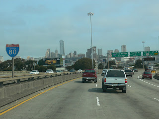
Leaving San Francisco, we took I-80 (crossing the Bay Bridge) towards Oakland.


familiar views?

7.06.2007

atlas pt.12 (CA-58 to I-5)


San Luis Reservoir
We knew we could have made our way to San Francisco on our third day, but since we had to go to the realtor to get our keys by 5 pm, we stayed one more nights at a place called Gilroy (the garlic town).

We reached Gilroy at 3:36pm


The last day of our cross America Trip... Day 4

The next day we left Gilroy at around 8:26 am. We had a rather late start because we knew we had only a few miles to go to San Francisco.
Our trip was finally coming to an end. It was kind of sad being done with our moving trip and knowing the end of the move means looking for a job. But I was sure Shannon was excited to not have to get back in the truck since he drove us all the way to San Francisco.


And finally, we got to our new home in San Francisco around 11:00am (June 15, 2007)

atlas pt.11 (CA-58 to I-5)


The mountain range in front of us was layed out around
Tehachapi and it seemed like Bakersfield was on the other side of this mountain range. When we got to Bakersfield as we got onto CA-58 which eventually ran into I-5.


The scenery had been changing as we went up toward the Northern part of California. More variations in the altitude, much taller vegetation and it all looked to be changing from the desolated look of the Mojave desert.
There were many farms along CA-58. Apricots, carrots, and many other fresh california grown fruits and vegetables were possibly from here.

How about a California grown cow?

atlas pt.10 (I-40)


Barstow we stopped to get our breakfast at 9:45am


Around Mojave Desert


We started to see these farmers' fruit stands...the fruit looked very delicious. I was too busy drooling that I missed a photo opportunity. If we had more time I would have stopped to get something.

I-40 ended so we took CA-58 to get onto I-5

atlas pt.9 (I-40)

DAY 3


We left Kingman, AZ at 6:00am.

キングマンを朝の6時に出発。テネシー時間朝の8時、ここまでくるともうテネシーと2時間差があるので朝の5時に起きる事も全然苦痛ではない。アリゾナの早朝は以外に涼しく昨日の熱風を忘れさせてくれる。「今のうちに砂漠を越えなくては!!」私たちにはまだMojave Desertという砂漠が待っているのだ。砂漠の熱さを知らなかった私たちは第一回目の引っ越し横断で砂漠の過酷を十分に経験した。5回目になる今回だからこそ今までの経験を生かして、昨日は早めに就寝して早朝出発することにしたのです。


Yeah!!! We were finally coming into CALIFORNIA (at 6:54am) then we went through the California State Inspection near the border at 6:57am. California was the only state where they had the state border inspection.

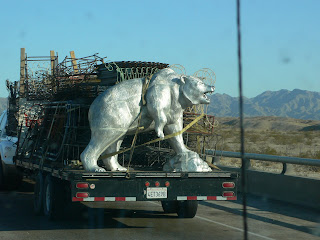
California Sliver bear??

テネシーから出発してオークラホマ辺りまでは1gallon= $2.89だったのにテキサスに突入してから1gallon=$3.00街道を上昇中。トラックを満タンにするのに一回約$100.00近くかかる。私のBlack Bull (車)は満タンにしてもテネシーでは$32.00ぐらいなので初めて満タンにするのに$100.00近くも払ったときの衝撃はかなり強打。そんな訳でガソリン給油回数をいかに削減するために朝早くに出発したり、本当に熱くて死にそうにならない限りトラックのエアコンをつけないでなるべく1タンクを長持ちさせてきたんだけど。。。
やっぱりモハビデザートは「熱い」。

atlas pt.8 (I-40)

アリゾナと言えばきっとPhoenixとかTucsonの地名頭の中に浮上してくるが私たちはアリゾナでも北部を走っているためPhoenixもTucsonにも通らない。強いて言えばFlagstaffという町でそこから丁度 Los Angelesまでは492mileと標記されていた。(passed through Flagstaff at 4:53pm)
アリゾナ北部といっても涼しいわけじゃない。アリゾナはきっとテネシーより熱いし日本の夏と違ってこれこそまさに湿気のない熱さ。熱気と熱風だけが自分の周りを囲い、もし多分ドライヤーの中に閉じ込められてしまったらきっとこんな感じなのだろうと思う。もちろんこの辺りには木とか葉っぱなんてモノはない。だからきっと紅葉もなく、発芽もなく一年中この風景は変わらないんだろうと思う。最後にみた水はRIo Grandeの水だしこんなに熱かったら湿気なんてモノもきっと蒸発してなくなってしまったんだろう。


ペトリファイドフォレストは化石化してしまった森の国立公園で日本語では「化石の森」というみたい。気になる人は是非どうぞ http://www.nps.gov/pefo/

そしてDAY 2はアリゾナ州にあるKingmanで宿を見つける事にしました。Kingmanの時間はPacific Time Zoneになっていてまた1時間時間を遅らせる事になったためkingman到着時間午後7時。二日目はテキサスからアリゾナまでだけなのに一つ一つの州が大きくてとっても長く感じる道のりだった。アリゾナ州のお隣はカリフォルニアです!!


DAY 2 Amarillo, TX to Kingman, AZ (at 7:00pm) about 750 miles

7.04.2007

atlas pt.7 (I-40)


ときどき遠くに Union-Pacificという会社の(なのかな?)鉄道列車が走ってる。その鉄道列車は突然ニューメキシコの景色に現れて、突然曲がって消えていく。でもその鉄道列車が一瞬でも見えたとき、あの列車はこの大空とこの大地の間を何回駆け巡ったんだろうと思う。奇妙な時間が流れる。時間とは何か?時間とはどんな成分でなりたっているのか?時間に質があったらどんなものなんだろう?質 質 質?
不思議な気持ちになる。それは観念的上は動いてて、でも時々停止させることもできる。自分は時間を把握してるみたいだけど本当に摑む事ができなくて勝手に流れていったりする。。。私はそんな物にコントロールされているのかと思う事もあれは、私がコントロールしているみたいに気になったりするし。時間ってやつは本当に不思議な存在。
そしてその鉄道の終点は私の未知にあって、そしてその鉄道の周りにはその動きを反映し認識させるものがないぶん本当はずっとそこにあったのかも。。。


Rocky Walls began to hover over us and I heard Shannon saying we were coming really close to the Arizona border...

In a world of Capitalism, even the imitation of Indian Painting on the Rocks became a sign of possible consumerism.
Isn't that just a form of vandalism?


Look at the sign, we reached Arizona at 2:12pm... やっとアリゾナだ!!

7.03.2007

atlas pt.6 (I-40)

Every time we went through big cities I attempted to take a good picture or at least the picture that somewhat represented my first reaction of those cities. But I had not had any success in doing this... and here is another attempt. So bad...


This was shot in Albuquerque... and it was 11:45am. All my remembrance of Albuquerque is that the city was painted with colors of sandy pink and turquoise blue. Even the side of freeway over passes were painted with those colors and the warm sandy pink vibrated against the clear blue sky... a feeling of heat outside of the window was so intensified by the colors.

This is Rio Grande...

I had an image of the Rio Grande being such a titanically big river...Maybe from the impression of the sound? Perhaps it used to be bigger? Until this point of our trip, I could not count how many traces of rivers along the road I had seen. How long those river had been without any drops of water I could not detect. But everytime we went across those river beds on the surface of the earth, I was reminded of Al Gore's "An Inconvenient Truth". The GLOBAL WARMING is real and it is drying up our land. What can I possibly do?
The documentary provided me with very important knowledge about this problem. But since the time I witnessed that evidence of former rivers I have been realizing the degree of the problem was much more serious.


The road with the white bridge was the Historic ROUTE 66... Yes it still exists partially and we could see old vacant gas stations here and there which seemed to be along the route.


We began to see rocky mountains all along the sides of the road... we were approaching the Arizona state border.